Day 6 - Due 11/12(A) 11/13(B) |
2.2 - Geologic History & Mapping |
Globes are difficult to make and carry around, and they cannot be enlarged to show the details of any particular area. As a result, people need maps.
Maps as Models
A map is a visual representation of a surface with symbols indicating important features. Different types of maps contain different information. Examples of some maps that are important in Earth science are:
Map Projections
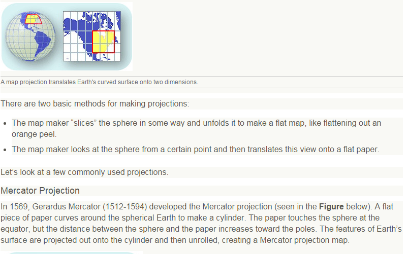
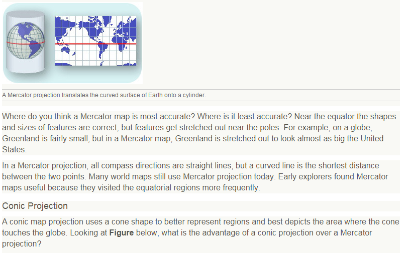
Maps are 2-dimensional (2D) representations of a 3-dimensional (3D) Earth. In a small area, Earth is essentially flat, so a flat map is accurate. But to represent a larger portion of Earth, map makers must use some type of projection to collapse the third dimension onto a flat surface. A projection is a way to represent the Earth’s curved surface on flat paper. One example of a projection is shown in the Figure below.
Maps as Models
A map is a visual representation of a surface with symbols indicating important features. Different types of maps contain different information. Examples of some maps that are important in Earth science are:
- Relief maps use color to show elevations of larger areas.
- Radar maps topography or weather.
- Satellite-view maps show terrains and vegetation, such as forests, deserts, and mountains
- Climate maps show average temperatures and rainfall.
- Weather maps show storms, air masses, and fronts.
- Topographic maps show elevations using contour lines to reveal landforms
- Geologic maps detail the types and locations of rocks found in an area
Map Projections
Maps are 2-dimensional (2D) representations of a 3-dimensional (3D) Earth. In a small area, Earth is essentially flat, so a flat map is accurate. But to represent a larger portion of Earth, map makers must use some type of projection to collapse the third dimension onto a flat surface. A projection is a way to represent the Earth’s curved surface on flat paper. One example of a projection is shown in the Figure below.
Questions:
1. Why are there more than one type of map projection?
2. Describe each type of map projection
3. Where do you think a Mercator projection is most accurate? Least accurate?
4. What is the advantage of a conic projection over a Mercator projection?
1. Why are there more than one type of map projection?
2. Describe each type of map projection
3. Where do you think a Mercator projection is most accurate? Least accurate?
4. What is the advantage of a conic projection over a Mercator projection?
